
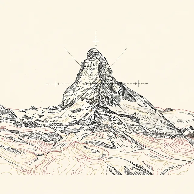
Matterhorn Viewpoints in Zermatt
Every angle on the Horu — Gornergrat, Riffelsee, Glacier Paradise, Rothorn and Stellisee, plus the best village views — read by altitude and reached by lift and cog.

Photo: Ilia Bronskiy / Unsplash
- ✓The Matterhorn — the Horu in the old Walliser tongue — rises to 4,478 m above a car-free village at 1,608 m.
- ✓Gornergrat (3,089 m) is the highest open-air railway station in Europe, level with 29 four-thousanders.
- ✓Riffelsee and Stellisee both mirror the peak on a still morning; sit on the right of the cog going up.
- ✓Read the mountain by altitude, not address — every viewpoint is a station height on the valley's three lift lines.
One peak, three lift lines, many angles
There is only one Matterhorn, but there is no single 'best' view of it — there is a whole library of them, each shifting with altitude, time of day and which side of the valley you stand on. The mountain the Walliser call the Horu is famously a near-perfect pyramid, but that pyramid only looks like the postcard from certain angles; move around it and the four ridges and four faces rearrange into shapes you would barely recognise. Choosing where to see it is the central pleasure of a Zermatt trip, and this hub gathers the contenders so you can pick by weather, effort and the hours you have.
The simplest way to hold it all in your head is to read the valley by height rather than by name. Zermatt sits on the valley floor at 1,608 m, and three lift systems climb out of it: the Gornergrat cog railway up the central ridge, the Sunnegga–Rothorn funicular and gondolas on the eastern flank, and the Matterhorn Glacier Paradise cable-cars climbing the western side toward the glacier. Every viewpoint below is really a station altitude on one of those lines, and once you think in metres the whole geography of the place clicks into focus.
What follows is the romantic logic and the practical detail for each: the great open-air balcony of Gornergrat; the mirror lakes of Riffelsee and Stellisee; the highest viewpoint in the Alps at Glacier Paradise; the eastern eyrie of Rothorn; and the views you get for free, without a lift ticket, from the village itself. Together they make a ladder of vantage points you can climb across a few days — and a single clear morning, spent on the right one, can be the memory you carry home.

At a glance
A quick orientation card for the headline viewpoints. Altitudes are fixed facts; times, tickets and opening all change with the season and the weather, so verify the current operating details on the official sites before you travel.
- Village (Zermatt): 1,608 m — car-free; the classic free view is up the Bahnhofstrasse and from the Kirchbrücke (church bridge).
- Sunnegga: ~2,288 m — quick funicular from the village; gateway to the eastern lakes and Rothorn.
- Stellisee: ~2,537 m — the great reflection lake, reached from Blauherd; still mornings only.
- Riffelsee (Rotenboden): ~2,757 m — the famous mirror pool a short walk below the Gornergrat summit.
- Rothorn: ~3,103 m — eastern-side panorama looking across at the peak.
- Gornergrat: 3,089 m — open-air terrace, Kulmhotel and the broadest 360° sweep.
- Matterhorn Glacier Paradise: 3,883 m — the highest viewpoint reachable by cable-car in the Alps.
Gornergrat — the open-air balcony
If you do one viewpoint, do Gornergrat. The cog railway has bitten its way up the central ridge since 1898 — Switzerland's first fully electric rack railway — and in around half an hour it lifts you from beside the main station to an open-air terrace at 3,089 m, the highest open-air railway station in Europe. The reward is not just the Matterhorn but the company it keeps: a ring of 29 four-thousanders including the Dufourspitze, the highest summit in Switzerland, and the Gorner glacier spilling below in a frozen river of ice.
It is also the most reliable view in terms of effort versus payoff. You ride, you step out onto a paved terrace, and the panorama is simply there — no scrambling, no exposure, suitable for almost anyone. Go early for the cleanest light and the shortest queues, sit on the right-hand side of the train going up for the Matterhorn (the glacier opens on the left near the top), and treat the upper stations as stops to break the journey rather than a single ride to the summit and straight back.

Riffelsee — the mirror below the summit
A short, easy walk below the Gornergrat summit, at the Rotenboden station, lies the most famous photograph in Zermatt: the Matterhorn doubled in the still water of the Riffelsee. On a windless morning the little tarn turns to glass and the whole pyramid hangs upside down in it, ringed by alpine flowers in early summer. It is the kind of view that needs almost nothing of you — get off the cog one stop early, walk a few minutes downhill, and there it is.
The catch is the word 'still'. The mirror only works when the air is calm, which in practice means early, before the day's breeze ruffles the surface. Aim for the first trains, accept that an afternoon visit will likely show you ripples rather than a reflection, and remember there are actually two pools here — if the lower one is disturbed, the smaller upper pool sometimes holds its calm a little longer. Even without the reflection it is a lovely, gentle place to sit.

Stellisee and the eastern flank
On the opposite side of the valley, the Sunnegga–Rothorn system opens an entirely different relationship with the peak. From the village a funicular whisks you up to Sunnegga in minutes, and a further lift to Blauherd puts you within an easy walk of Stellisee — the other great reflection lake, and the centrepiece of the much-loved Five Lakes Walk. Many photographers rate the Stellisee reflection above Riffelsee's: the foreground is wilder, the crowd often thinner, and the morning light falls kindly on the face from here.
Stellisee rewards the same discipline as Riffelsee — go early, hope for stillness, go anticlockwise on the loop to take the reflection first. But the eastern side has more to give than one lake. The Five Lakes Walk strings Stellisee together with Grindjisee, Grünsee, Moosjisee and Leisee, each framing the Matterhorn a little differently, and higher up the Rothorn delivers a full panorama from 3,103 m. This is the flank for walkers who want the peak as a companion across a half-day rather than a single fixed vantage.


Matterhorn Glacier Paradise — the highest of all
For sheer altitude, nothing in the Alps beats Matterhorn Glacier Paradise. Cable-cars climb the western side of the valley to a viewing platform at 3,883 m — the highest you can reach by lift on the continent — into a world of permanent snow and ice where summer skiing carries on and the air is thin enough to slow your steps. From here the Matterhorn shows you a steeper, more brutal profile than the postcard pyramid, and the panorama sweeps across the Alps into Italy.
This is the viewpoint to choose for the high-mountain experience itself — glacier, ice and the strange, blue light at altitude — rather than the perfect classic silhouette. Dress as if for winter whatever the calendar says, take the altitude seriously and slowly, and be especially ready to re-plan: the top is exposed to weather and can close in wind, so this is the one to keep flexible and to spend on a settled, clear day.

The views you get for free, in the village
Not every great view costs a lift ticket. The village itself, at 1,608 m, frames the Matterhorn beautifully — and famously. The single most photographed angle in Zermatt is from the Kirchbrücke, the little church bridge over the river, where the peak rises directly above the rooftops and the water; come at first light and you may catch the alpenglow turning the face pink with the village still asleep beneath it. Strolling up the car-free Bahnhofstrasse, the peak closes the end of the street like a stage backdrop.
For couples especially, these free, in-village views are part of the romance of the place. You do not have to be on a glacier to be moved by the Horu; you can be standing on a bridge with a coffee, or looking up from a hotel balcony at dawn. Wander the lanes of the old quarter, the Hinterdorf with its weathered timber Walliser barns, and you keep catching the peak between the buildings. The lifts give you the grand panoramas — but the village gives you the quiet, intimate ones, and those are often the views people remember best.

How to choose, and how to plan around the weather
With this much choice, the trick is not to try to do it all in a hurry. A good first trip can manage Gornergrat plus Riffelsee in a single morning, since they share a railway, and then give a separate day to the eastern flank — Sunnegga, Stellisee and as much of the Five Lakes Walk as you fancy. Glacier Paradise deserves its own outing on a settled day. If you have only one clear window, spend it on Gornergrat: it gives the broadest panorama for the least effort, and it orients you to everything else.
Above all, build the plan around the weather rather than the calendar. The Matterhorn makes its own clouds, and a peak wrapped in mist is no peak at all, so keep your headline viewpoint flexible until the forecast firms up and be ready to swap days. Reflections need stillness and so reward the earliest trains; high viewpoints reward clear, calm conditions and punish wind. Whatever you choose, dress warmer than the valley feels — even a hot August morning is cold at 3,000-plus metres — carry sun protection, and check the official lift and railway sites for live status before you ride. Get the timing right and the mountain will give you the view you came for.
- First trip, one morning: Gornergrat + Riffelsee (same railway).
- A second day: Sunnegga, Stellisee and the Five Lakes Walk on the eastern flank.
- A settled day of its own: Matterhorn Glacier Paradise for the high-glacier experience.
- One clear window only: choose Gornergrat — broadest view, least effort.
- Reflections need calm, early air; high viewpoints need clear, wind-free weather.
- Dress for winter at altitude, carry sun protection, and check live lift status before you go.
Map pins
Map data © OpenStreetMap contributors · Tiles © OpenFreeMap